Data provided by TravelTime

Last Updated:
5.3 miles to Emerson College
Floor Plan Models and Units
Number of BedroomsNumber of BathroomsRent RangeSquare FootageName of Floor PlanUnit NumberAvailabilityNewly AddedView More Details
Beds Baths Rent Sq. Ft. Availability
1 Bathroom Call for Rent 700 Available Now
Available NowCall for Rent700Sq. Ft.
* Price shown is base rent and may not include non-optional fees and utilities. View Fees and Policies for details. Price, availability, fees, and any applicable rent special are subject to change without notice. * Square footage definitions vary. Displayed square footage is approximate.

Convenient For

  • Undergraduates
  • Graduate Students
  • Faculty/Staff

259 Billings St

Prime location - super CONVENIENT commute to MGH, Park Street Station, MIT, Harvard etc. Walking distance to North Quincy Red line T-Station. Most importantly 2 minutes’ walk to Wollaston Beach for any beach lovers.

Beautiful and sunny 5 rooms...
apartment (living/dining/bedroom/kitchen/bathroom) with a private deck! Second-floor, hardwood floors through out, and a newly renovated kitchen! Classic apartment with charm. Heat and water is included! Tenant has their independent electricity and gas system. Require first, last and one month security deposit. Sorry, No Pets, no smoking. No broker fee!

Expenses

Included Utilities
Utilities
Expense Type Fee
Heat Included
Trash Removal Included
Water/Sewer Included

Contact

Protect yourself from fraud. Do not send money to anyone you don't know.

Amenities

Unit Features

  • Hardwood Floors
  • Heat - Central
  • Heat - Floor/Wall
  • Heating
  • Kitchen
  • Patio, Balcony, Porch or Deck
  • Smoke-Free

Shopping Centers

North Quincy Plaza <span class="bold">Walk:</span> <span class="mobile-font">22 min</span> <span class="mobile-font">(1.2 mi)</span>
Yanni's Plaza <span class="bold">Walk:</span> <span class="mobile-font">23 min</span> <span class="mobile-font">(1.2 mi)</span>
Neponset Circle Shopping Center <span class="bold">Walk:</span> <span class="mobile-font">29 min</span> <span class="mobile-font">(1.5 mi)</span>

Military

Boston Support Center <span class="bold">Drive:</span> <span class="mobile-font">15 min</span> <span class="mobile-font">(8.1 mi)</span>

Transit / Subway

North Quincy Station <span class="bold">Walk:</span> <span class="mobile-font">16 min</span> <span class="mobile-font">(0.9 mi)</span>
Wollaston Station <span class="bold">Walk:</span> <span class="mobile-font">30 min</span> <span class="mobile-font">(1.6 mi)</span>
Quincy Center Station <span class="bold">Walk:</span> <span class="mobile-font">54 min</span> <span class="mobile-font">(2.8 mi)</span>
Cedar Grove Station <span class="bold">Walk:</span> <span class="mobile-font">49 min</span> <span class="mobile-font">(2.5 mi)</span>
Ashmont Station <span class="bold">Walk:</span> <span class="mobile-font">48 min</span> <span class="mobile-font">(2.5 mi)</span>
Butler Station <span class="bold">Walk:</span> <span class="mobile-font">55 min</span> <span class="mobile-font">(2.9 mi)</span>
Morton Street <span class="bold">Drive:</span> <span class="mobile-font">7 min</span> <span class="mobile-font">(4.2 mi)</span>
Four Corners/Geneva <span class="bold">Drive:</span> <span class="mobile-font">11 min</span> <span class="mobile-font">(4.2 mi)</span>
Talbot Avenue <span class="bold">Drive:</span> <span class="mobile-font">9 min</span> <span class="mobile-font">(4.4 mi)</span>
Jfk/Umass <span class="bold">Drive:</span> <span class="mobile-font">9 min</span> <span class="mobile-font">(4.7 mi)</span>

Airports

General Edward Lawrence Logan International <span class="bold">Drive:</span> <span class="mobile-font">18 min</span> <span class="mobile-font">(9.7 mi)</span>

Colleges and Universities Nearby

UMass Boston <span class="bold">Drive:</span> <span class="mobile-font">10 min</span> <span class="mobile-font">(4.3 mi)</span>
Tufts University, Boston <span class="bold">Drive:</span> <span class="mobile-font">12 min</span> <span class="mobile-font">(6.7 mi)</span>
Northeastern University <span class="bold">Drive:</span> <span class="mobile-font">13 min</span> <span class="mobile-font">(6.8 mi)</span>
Wentworth Inst. of Technology <span class="bold">Drive:</span> <span class="mobile-font">13 min</span> <span class="mobile-font">(7.0 mi)</span>

Parks and Recreation

Squantum Point Park <span class="bold">Walk:</span> <span class="mobile-font">37 min</span> <span class="mobile-font">(1.9 mi)</span>
Adams National Historical Park <span class="bold">Walk:</span> <span class="mobile-font">48 min</span> <span class="mobile-font">(2.5 mi)</span>
Dorchester Shores Reservation <span class="bold">Drive:</span> <span class="mobile-font">9 min</span> <span class="mobile-font">(4.3 mi)</span>
Franklin Park Zoo <span class="bold">Drive:</span> <span class="mobile-font">11 min</span> <span class="mobile-font">(6.0 mi)</span>
Lower Neponset River Trail <span class="bold">Drive:</span> <span class="mobile-font">11 min</span> <span class="mobile-font">(6.1 mi)</span>

Ratings

Car-Dependent

34

Walk Score ®

Out of 100

This area is considered a car-dependent area and most errands will require a car.
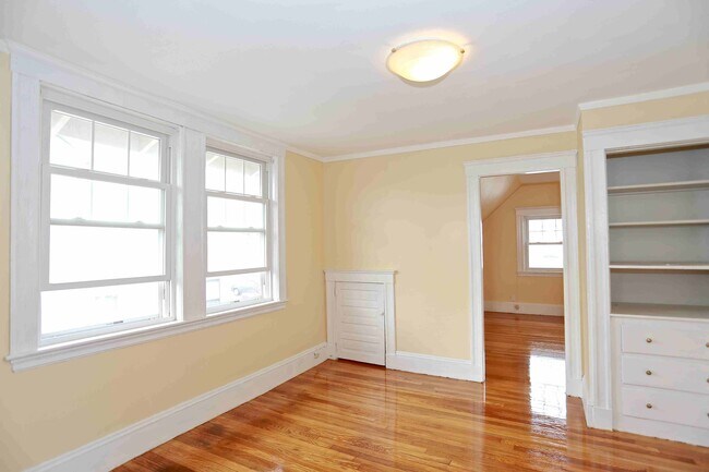
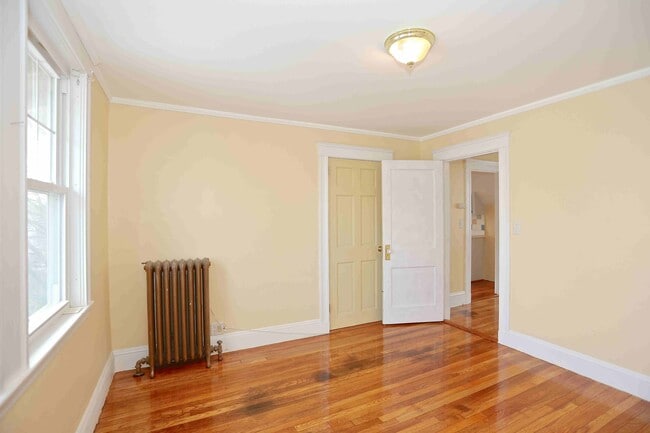
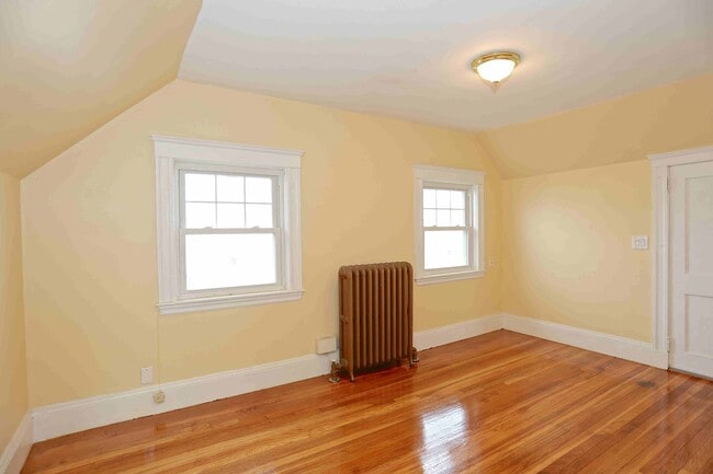
Some Transit

48

Transit Score ®

Out of 100

You'll likely want a car when living in this area since it has few transit options.

Somewhat Bikeable

48

Bike Score ®

Out of 100

You might be able to find places to ride your bike in this area, but you’ll most likely want your car for most errands.

Active

74

Soundscore â„¢

Out of 100

Traffic:

Active

Airport:

Calm

Business:

Calm

Protect yourself from scams.  Learn More